Thinking about making a move to Charleston? You’re not alone. From historic streets and world-class dining to beach towns and suburban comforts, the region offers distinct lifestyles within a short drive of each other. In this guide, you’ll learn how the metro is organized, what each major area feels like, and the practical trade-offs to consider so you can focus your search with confidence. Let’s dive in.
How Charleston is organized
Charleston centers on a historic peninsula surrounded by rivers, marshes, and barrier islands. Those waterways shape everyday life. Bridges and causeways connect neighborhoods, and a limited number of crossings create predictable traffic chokepoints during rush hours.
Locals use simple geographic shorthand to navigate the metro:
- Peninsula/Downtown
- Mount Pleasant (east of the Cooper River)
- North Charleston (including Park Circle)
- West Ashley (west of the Ashley River)
- James Island and Johns Island
- Barrier islands (Isle of Palms, Sullivan’s Island, Folly Beach)
- Farther-out suburbs (Summerville, Goose Creek, Moncks Corner, Hanahan)
Neighborhood snapshots
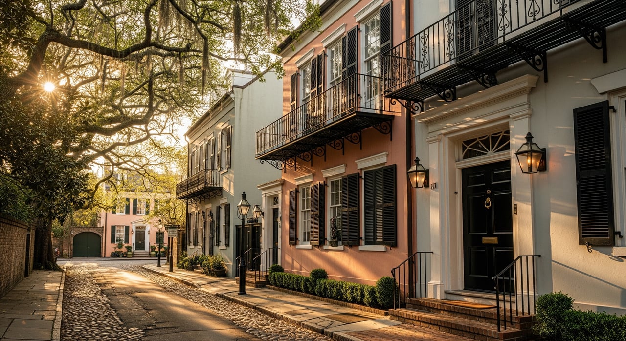
Peninsula / Downtown Charleston
If you want a walkable, culture-forward lifestyle, the Peninsula puts you close to restaurants, museums, and historic streets. Housing ranges from classic “Charleston single” homes and restored rowhouses to luxury condos and smaller converted flats. Parking is limited, preservation rules are strict, and flood risk varies by block, but commutes are short and many jobs sit right here.
Prices in the historic core trend toward the higher end of the metro, especially near the water. You’ll trade yard space for architectural character and proximity to nightlife and the arts.
Mount Pleasant
East of the Cooper River, Mount Pleasant blends neighborhood amenities with access to beaches and the Ravenel Bridge into downtown. You’ll find planned communities, townhomes, and a wide range of single-family homes, including newer construction. Commutes to the Peninsula are straightforward via the bridge, though peak-hour traffic is common.
Pricing runs upper-mid to high compared to the metro, with premium pockets near waterfront areas and established neighborhoods. Buyers often choose Mount Pleasant for its community amenities and a suburban feel close to the city.
Daniel Island
This planned island community offers newer construction, parks, retail, and office space woven into one walkable setting. Housing includes townhomes, condos, and single-family homes in both gated and non-gated areas. You get quick access to downtown, Mount Pleasant, and major employment centers while keeping a calmer suburban pace.
Prices are generally on the higher side due to the amenity mix and newer homes. Many relocators appreciate the convenience and master-planned design.
North Charleston (including Park Circle)
North Charleston is diverse and dynamic, home to the airport, Joint Base Charleston, port-related industries, and a growing mix of residential neighborhoods. Park Circle, in particular, has seen new infill and redevelopment alongside established homes and apartments. Commutes vary, with many residents working in aviation, logistics, manufacturing, or downtown.
You’ll find a wide price range, from more affordable pockets to mid-priced areas with ongoing change. It’s a practical choice if you want options near major employers and transportation.
West Ashley
West of the Ashley River, this area offers an established suburban feel with older cottages, ranches, and newer subdivisions. Many homes have yards, and you can reach downtown via several bridges and causeways. Commute times are moderate and depend on your specific corridor.
Prices are often more accessible than the Peninsula and Mount Pleasant. Neighborhood character varies, so it helps to tour different pockets to see what fits your daily rhythm.
James Island and the Barrier Islands
James Island puts you close to coastal recreation and Folly Beach while keeping downtown within reach. Housing includes single-family homes and coastal-style designs. The barrier islands offer a more direct beach lifestyle: Sullivan’s Island and Isle of Palms lean residential with premium pricing, while Folly Beach has a casual vibe and a mix of homes and condos.
Expect seasonal traffic spikes around holidays and summer. Elevated homes, HOA rules, and flood and storm considerations are common, so factor insurance and maintenance into your budget.
Johns Island and Wadmalaw Island
If you want more land and a low-density feel, Johns Island and neighboring Wadmalaw Island provide larger lots, newer subdivisions, and rural settings. You’ll also find high-end waterfront estates in certain pockets. Commutes to downtown are longer, which many buyers accept in exchange for privacy and space.
Infrastructure can be less developed in some areas. Verify flood and marshland mapping, road access, and utilities for any property you consider.
Summerville, Goose Creek, and Moncks Corner
Farther from downtown, these suburban and exurban communities attract buyers seeking value, larger yards, and newer master-planned neighborhoods. Many residents commute to North Charleston, the airport, or other job nodes along I-26. Downtown commutes can run 30 to 60 minutes or more depending on your location and traffic.
Prices are generally more affordable than core Charleston neighborhoods. Growth is steady, so monitor how new development affects commute corridors and daily routines.
Commutes and bridges
Bridges matter in Charleston. The Arthur Ravenel Jr. Bridge links Mount Pleasant to the Peninsula and sees heavy peak-hour flow. Other spans over the Ashley and Cooper Rivers, plus causeways to the islands, create funnel points where traffic can back up.
If you plan to drive daily, map your likely route and weigh proximity to a key crossing. CARTA provides bus service in the region. Walking and biking are practical on the Peninsula and in certain planned communities, while most suburbs and exurbs rely on car travel. Ride-share availability is strong in urban and tourist areas and more limited farther out.
Quick lifestyle match guide
Use these signals to narrow your short list:
- Walkable nightlife and culture: Peninsula, parts of King Street-adjacent areas, Park Circle, Daniel Island
- Suburban amenities and neighborhood feel: Mount Pleasant, Daniel Island, parts of Summerville
- More space and value focus: West Ashley, Summerville, parts of North Charleston and Goose Creek
- Beach and coastal living: Isle of Palms, Sullivan’s Island, Folly Beach
- Acreage and quiet near the city: Johns Island, Wadmalaw Island, outskirts of Summerville
Key relocation checks
Flood and insurance
Much of coastal Charleston is shaped by tidal creeks and marshes, so flood exposure varies by neighborhood and even by block. Review current FEMA flood maps and ask for any recent elevation certificates for properties you’re considering. Flood insurance, whether through the NFIP or private carriers, can be a significant cost, so confirm availability and estimated premiums early.
Rules, zoning, and HOAs
Historic areas downtown have strict preservation and design guidelines that shape renovations and new construction. Many suburban communities include HOA rules that affect exterior changes, landscaping, and rental policies. Before you fall in love with a home, request the relevant guidelines so you know what is allowed.
Property taxes and carrying costs
South Carolina property tax rates are generally modest compared to many states, but effective taxes vary by county and assessment. Coastal homes may carry higher insurance considerations, including hurricane deductibles. Build a full monthly budget that includes utilities, HOA dues, and insurance so there are no surprises.
Schools and public services
Multiple school districts serve the Charleston metro. District boundaries can change with growth, and school options are a frequent driver for neighborhood selection. Verify current boundaries and enrollment rules directly with the district that serves the home you are considering.
Employment hubs and growth
The region’s job base includes healthcare and higher education on the Peninsula, the Medical University of South Carolina, and a concentration of aviation, port, and industrial employers in North Charleston. New commercial projects and port activity can affect traffic patterns and housing demand. If proximity to work is key, consider how planned growth may change your commute.
Test drives and timing
Plan a few test drives during peak hours for any neighborhood on your short list. Visit on a weekend and a weekday to get a feel for noise, parking, drive times, and access to daily needs. If you are weighing a beach or marshfront home, time a visit around high tide to understand local conditions.
Putting it all together
Every Charleston area comes with trade-offs across commute, space, price, and flood exposure. The Peninsula offers walkability and culture with higher prices and parking constraints. Mount Pleasant and Daniel Island deliver suburban convenience near beaches, with upper-mid to high pricing. West Ashley and parts of North Charleston can offer more value and yard space with moderate commutes. The islands and coastal areas provide beach access and a unique lifestyle, balanced by seasonal traffic and insurance considerations. Farther-out suburbs stretch your dollar and lot size, with longer daily drives.
If you’re relocating, a focused plan saves time:
- Define your top two priorities, such as commute or beach access.
- Shortlist two or three submarkets that match those priorities.
- Run sample commutes and review flood mapping for each area.
- Request HOA documents, renovation rules, and utility estimates before you bid.
When you’re ready to tour or compare neighborhoods side by side, connect with a local guide who can help you weigh these trade-offs in real time.
Ready to find your fit in Charleston? For tailored neighborhood tours, property vetting, and clear next steps, reach out to Kimberly Lease for trusted, concierge-level guidance.
FAQs
What should I know about Charleston flood zones before buying?
- Check current FEMA flood maps and ask for elevation certificates on specific properties, then confirm insurance availability and estimated premiums early in your process.
How do Charleston bridges affect daily commutes?
- A limited number of river crossings concentrate traffic, so proximity to key bridges like the Ravenel Bridge can significantly impact drive times during rush hours.
Which Charleston areas offer walkable living near restaurants and culture?
- The historic Peninsula is the most walkable, and parts of Park Circle and Daniel Island also provide pedestrian-friendly pockets with dining and services.
Where can I find more yard space and relative value near Charleston?
- West Ashley, Summerville, and parts of North Charleston and Goose Creek often provide larger lots and more options at mid-level price points.
What are the trade-offs of living on Charleston’s barrier islands?
- You get beach access and coastal lifestyle while taking on seasonal traffic, elevated storm and flood exposure, HOA considerations, and coastal insurance costs.
How should I compare school options when relocating to Charleston?
- Verify current district boundaries and enrollment policies for any home you’re considering, and review official district resources for the most accurate, up-to-date information.